
Bartonsville, Vermont around 1860
The Bartonsville Covered Bridge was built as as the result of a historical flood and was destroyed as result of a historical flood. For 140 years the covered bridge was the gateway to Lower Bartonsville, Vermont a small hamlet in the Town of Rockingham in Windham County.
The bridge was built after the Great Flood of 1869 changed the course of the Williams River in Bartonsville. Prior to the flood, the river flowed around a bend and powered the paper mills in Bartonsville. In October 1869, after days of torrential rains, the river jumped the banks and took the shortest path of resistance and went straight through the center of the village. Six homes, the brand new train depot, and a large section of the railroad tracks were washed away during the flood of 1869. It is not known if the covered bridge that crossed the river before the mills survived the flood and was taken down later or if was washed away before the river changed course.
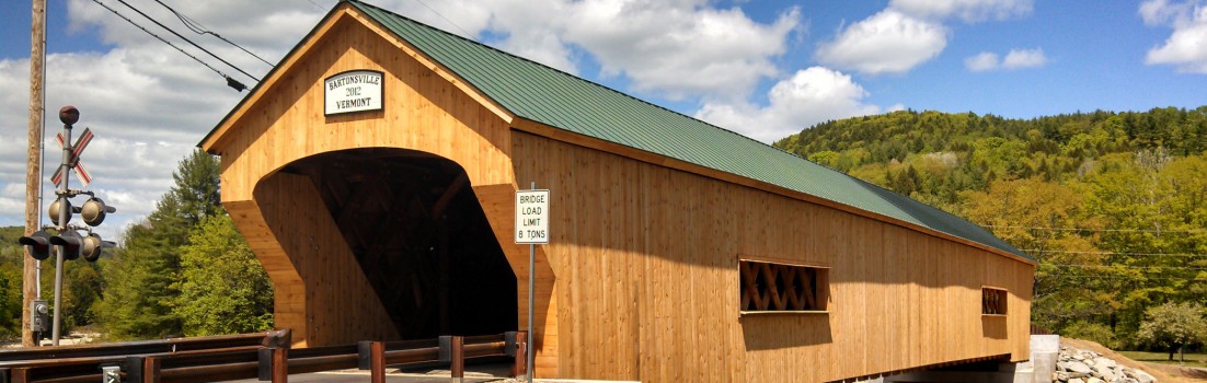
In need of a new bridge over the Williams River the services of a local bridge builder named Sanford Granger were obtained. Granger, built many of the covered bridges in the Rockingham area including the Worral Bridge about a mile further down stream. The new bridge was built in the Town lattice truce style with a wooden tread. The bridge was 151 feet long, the largest in Windham county and the second longest covered bridge in Vermont. It was listed on the National Registry of Historic Places.
 Originally the bridge did not have any windows cut into the siding and over the years it underwent a variety of cosmetic and structural repairs. The bridge survived the major floods of 1927 and 1938. In the early 1960s a town gravel truck went through the floor of the bridge although the housing remained intact. The bridge underwent major renovations in the early 1980s to reinforce the stone abutments with concrete, replace siding, shore up the floor support system, replace broken truces, and install green metal roofing. Minor damaged occurred to the bridge over the next few decades as over height vehicles damaged the roof beams.
On August 28, 2011, when the Williams River again rose to historic heights during Tropical Storm Irene, the bridge withstood dozens of large trees scraping its bottom and lashing its side. The bridge withstood the torrent for most of the day, however eventually the raging water undermined the abutments on the south side of the bank. At 3:40 pm the concrete and stone abutments crashed into the water. The bridge gracefully released from the banks, floated upon the top of the water and set sail down the river. Unable to make the turn in the river the bridge it flipped on its side and collapsed on shore about a half mile down stream.
